Seeing these beaches may make your heart beat faster!
Should you ever be in need of health care assistance in any of these locations then look on www.medihoo.com/search
Navagio Beach
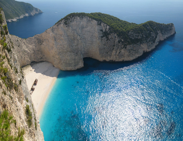 flickr/dkilim
Shipwreck Beach, is an exposed cove, sometimes referred to as ‘Smugglers Cove’, on the coast of Zakynthos, in the Ionian Islands of Greece. It has been so named since 1983, when the alleged smuggler ship Panagiotis was wrecked on the beach while transporting cigarettes. located on the north-west shore of Zakynthos (Zante), in the Municipality of Elation. The area is defined by its sheer limestone cliffs, white sand beaches, and clear blue water, which attract thousands of tourists yearly. The strip of beach is accessed only by boat. Regular tours to the beach depart from Porto Vromi to the south, and from Agios Nikolaos and Cape Skinari to the north-east. Boats also arrive from the harbour of Zakynthos city. (wikipedia)
The Baths
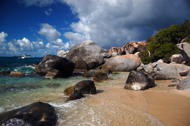 flickr/super-structure
The Baths are a beach area on the island of Virgin Gorda among the British Virgin Islands in the Caribbean.
At The Baths, the beach shows evidence of the island’s volcanic origins, which deposited granite that eroded into piles of boulders on the beach. The boulders form natural tidal pools, tunnels, arches, and scenic grottoes that are open to the sea.[2] The largest boulders are about 40 feet (12 m) long.
Since 1990, the area has been a BVI National Park as are the adjacent bays, and the area is a major tourist attraction, with swimming and snorkelling being the main attractions. (Wikipedia)
Tapuaetai
 flickr/Rowen Atkinson
Tapuaetai or One Foot Island is one of 22 islands in the Aitutaki atoll of the Cook Islands. It is located on the southeastern perimeter of Aitutaki Lagoon immediately to the southwest of the larger island of Tekopua, seven kilometres to the east of the main island of Aitutaki. (Wikipedia)
Zlatni Rat
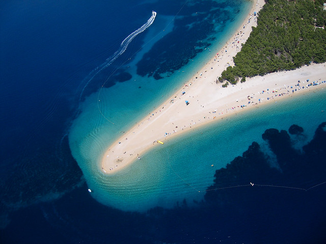 flickr/Emich
Often referred to as the Golden Cape or Golden Horn (translated from the local Chakavian dialect), is a spit of land located about 2 kilometres (1 mile) west from the harbour town of Bol on the southern coast of the Croatian island of Brač, in the region of Dalmatia. It extends into the Hvar Channel, a body of water in the Adriatic Sea between the islands of Brač and Hvar, which is home to strong currents. The landform itself is mostly composed of a white pebble beach, with a Mediterranean pine grove taking up the remainder. (wikipedia)
Oludeniz
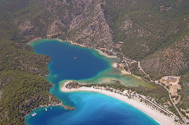 flickr/Sam and Ian
Due to its calm waters even during storms; official translation name Blue Lagoon) is a small village and beach resort in the Fethiye district of Muğla Province, on the Turquoise Coast of southwestern Turkey, at the conjunction point of the Aegean and Mediterranean seas. It is located 14 km (9 mi) to the south of Fethiye, near Mount Babadağ.
Ölüdeniz remains one of the most photographed beaches on the Mediterranean. It has a secluded sandy bay at the mouth of Ölüdeniz, on a blue lagoon. The beach itself is a pebble beach. The lagoon is a national nature reserve and construction is strictly prohibited. The seawater of Ölüdeniz is famous for its shades of turquoise and aquamarine, while its beach is an official Blue Flag beach, frequently rated among the top 5 beaches in the world by travelers and tourism journals alike. (Wikipedia)
Trunk Bay
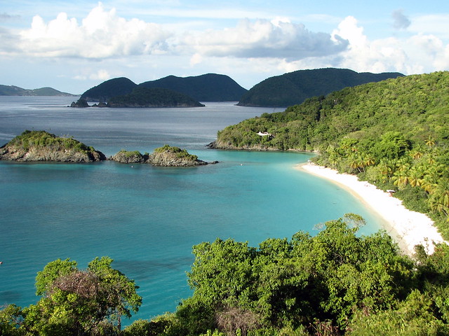 flickr/zeandroid
Trunk Bay is a body of water and a beach on Saint John in the United States Virgin Islands. It has consistently been voted one of the Ten Best Beaches in The World by Condé Nast Traveler magazine and has received similar recognition from other publications. The National Geographic Society has labeled Trunk Bay as the most beautiful beach in the world. It is one of the most popular beaches on the island whose amenities include a snack bar, showers and restrooms, lifeguards, and an underwater trail for snorkeling its coral reef. Trunk Bay is the only National Park beach on Saint John which requires a fee to visit. (Wikipedia)
Maya Bay
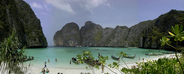 flickr/chilsta
Maya Bay is popular for diving, and has become even more popular after the 2000 movie The Beach was filmed there. According to the Lonely Planet’s Thailand guidebook, the 2004 tsunami dramatically improved the look of Maya Bay. This was due to the fact that the high waves had cleaned up the beach and removed all the landscaping the Fox production team had added.
The main dive sites are at Loh Samah, Maya Bay entrance and Palong Bay, and are often combined with diving at Ko Bida Noi, a rocky outcrop some 500 meters south of Loh Samah. (Wikipedia)
Whitehaven Beach
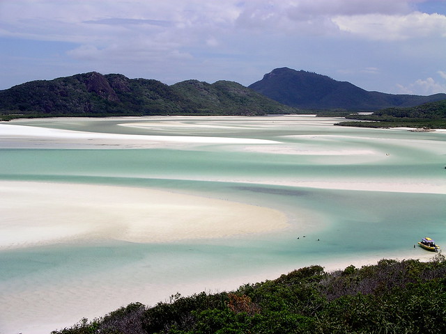 flickr/Vandelizer
Whitehaven Beach is a 7 km stretch along Whitsunday Island, Australia. The island is accessible by boat from the mainland tourist ports of Airlie Beach and Shute Harbour, as well as Hamilton Island. The Whitehaven Beach Ocean Swim is a 2 km open swimming competition held on the Beach in November each year as part of the Hamilton Island Triathlon Event. The 2012 event was held on 11 November 2012
The beach was awarded Queensland’s Cleanest Beach in Keep Australia Beautiful‘s 2008 Clean Beach Challenge State Awards. In July 2010, Whitehaven Beach was named the top Eco Friendly Beach in the world by CNN.com. Dogs are not permitted on the beach and cigarette smoking is prohibited.
Whitehaven Beach is known for its white sands. The sand consists of 98% pure silica which gives it a bright white color. Local rocks do not contain silica so it has been suggested that the sands were brought to the beach via prevailing sea currents over millions of years.
Unlike regular sand, the sand on Whitehaven Beach does not retain heat making it comfortable to walk barefoot on a hot day. This sand is also very fine, and can damage electronic equipment such as telephones and cameras, although it is good at polishing up jewellery[citation needed]. (Wikipedia)
Tulum
 flickr/CasaDeQueso
Tulum (Yucatec: Tulu’um) is the site of a Pre-Columbian Maya walled city serving as a major port for Cobá. The ruins are situated on 12-meter (39 ft) tall cliffs, along the east coast of the Yucatán Peninsula on the Caribbean Sea in the state of Quintana Roo, Mexico. Tulum was one of the last cities inhabited and built by the Mayas; it was at its height between the 13th and 15th centuries and managed to survive about 70 years after the Spanish began occupying Mexico. (Wikipedia)
Anse Source D’Argent
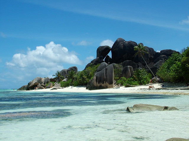
Source: List & Pictures – Touropia / Text: Wikipedia